In December 2023, I embarked on what I hoped would be a wondrous Christmassy trek.
The Cotswold Way.
A 102 mile route stretching from the top of the Cotswolds to the south.
A journey completed by thousands of curious hikers a year, coming from all around the world.
Below I want to take you through my experience of the Cotswold Way, and break down what I believe to be the ideal 7 day itinerary.
Information is scarce online, so I will try to make this guide as useful and as practical as possible.
Packed full of my own personal experience and providing tips & tricks I learned along the way.
Many of which I wish I knew BEFORE I left.
Let’s get into it …
This itinerary is broken up into 7 days, with the first and last days being half-days, and the other 5 being longer full days.
Why?
Well, glad you asked! It allows you to more easily adjust on the first day, and also take time to enjoy Chipping Campden if you wish.
And the last day gives time to explore Bath in the evening before having to shoot off.
Based on my schedule (and others online it seems) 7 days is a good target to make. It has some tough days, but some do it even faster.
It entails an average of about 8 hours walking a day (though this can vary) so can be achieved even in December when daylight hours fall as low as just 8 hours.
Which is when I did it!
Of course you can spend a day in each place on top of this itinerary if you so wish! But I liked the way this itinerary fit with my own schedule.
Plus, as you’ll see, it’s not always a clear case of doing a strict 14.5 miles a day and the town selection below is strategic for finding accommodation each night and having reasonable distances each day.

Distance walked: 10.5 miles
As my chosen route for the Cotswold Way was North to South, Chipping Campden was the start point.
More specifically … Market Hall.
Thai is in the heart of the town, conveniently directly opposite Coop, which is a useful spot to pick up your daily supplies.
Alternatively have lunch or breakfast in one of the many cute cafes here.
Next to Market Hall is a big circular plaque in the ground which marks the start/end of the Cotswold Way.
So find it, grab a photo, and get moving!
With delays to my train I didn’t have much more time to explore Chipping Campden, though it seemed lovely! Instead my day then began with an introductory uphill walk out of town, and out across some muddy fields.
Wonderful!
Remarkable highlights of the day include, as always in the Cotswolds, wonderful views.
It also passes through the village of Broadway. It was all lit up for Christmas when I passed through, which was lovely and was very busy with (what I assumed) were tourists.
There were a bunch of cute cafes and pubs here, but with a very pressing schedule I was gutted I couldn’t stop.
As it was the end of the day for me it was an hour spent walking in the dark. Again, not planned, but due to train delays.
You also get to pass by Broadway Tower before the town which is privately owned and apparently you can go inside for a fee.
It’s very well maintained and a great introduction to small British castles if you’re not accustomed to seeing these.
The day here ends in Stanton. A great little village absolutely packed with charm and history.
There is only one pub here, the Mount Inn, but luckily for you it’s absolutely cracking!
With a big log fire (if you visit in the colder months) and lots of seating space.
Just be sure to book a place in advance as apparently it can get fully booked. In which case your only option for dinner would be to order in takeaway.
I went for the Veggie Burger and I only imagined eating about half because it's huge! According to my Airbnb host, this is par for the course here and everyone is usually left unable to finish their meals! I suppose that’s better than being left hungry after a big day walking.
I kicked off my Cotswoldsian adventure by staying in, what I found to be, the epitome of a cute Cotswolds cottage.
Here is the listing, magical right?
It’s a shared room in a private house, which may not be to some people's liking (though they are building a separate cabin in the garden which is due to be finished in summer 2024.
Would I recommend staying here?
Hell to the yes!
Susan, the host, is an absolutely wonderful person. As is her partner. I wish I had more flexibility in my schedule to spend more time talking, but it was lovely meeting them.
They made me instantly feel right at home. I had a bath, which was sublime, the room was very cozy, and the breakfast was a wonderful touch.
Bottom line, if it’s free for your dates, book it (then message and thank me later).
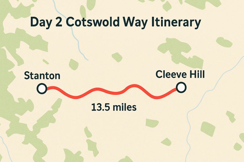
Distance walked: 13.5 miles
This day is another great way to ease into the schedule. Being roughly 4 miles short of the intended, ideal 17 miles/day target.
Again this was down to accommodation options, but honestly I’m glad it wasn't much further!
It’s still a fairly tough day by the end where I found my still-adjusting muscles and feet very sore. Here’s also a fair chunk of up and down this day.
Which isn’t exactly a surprise as Cleeve Hill is the highest point in the whole of the Cotswolds.
Surely that means it’s all downhill from here til Bath, right?
Ha, I (and you) wish.
Again, in terms of views, it’s absolutely stunning all … day … long.
With wonderful villages, houses, rolling hills and even an old derelict Abbey.
I stopped for lunch at the White Hart in the town of Winchcombe; much needed for some sore legs.
I benefited from the rain holding off all day, though it was very muddy underfoot, which made those inclines that little more challenging and there was a lot of boggy mud this day.
A key spot for the day is Cromwell’s Seat. Which has great views, but is historically (supposedly) the site where Oliver Cromwell watched the burning of Hails Abbey below (you walk past this after)
But much more impressive and shocking is Belas Knap.
Of all things you’d expect to stumble past in the Cotswolds, this is a 5,000 year old neolithic burial site where dozens of bodies have been discovered inside.
Other than this?
Expect plenty of cows, horses and sheep. All very British, all very wonderful.
I booked a room this night at the Rising Sun Hotel.
What can I say … well priced, comfy bed, large bath.
And best of all, a very large bar and restaurant area downstairs.
I ordered a Beyond Meat burger, my favorite fake meat, so I was very happy! Also a couple pints of Thatchers helped me feel better too …
Plus they were playing Christmas music.
IMAGE OF FOOD ON MY PHONE
Much better still though was breakfast. They had a great cold spread, with fresh fruit like blueberries and strawberries. But also included a hot breakfast order too, which surprised me. Making this stay incredible value and a great way to get you fed for the day ahead
This is a part of the Greene King pub chain. A group in the UK with a tonne of pubs across the country, with fair prices and (at least in this case) some character.
Some people may turn their nose up and go for something more independent. Either way it’s well located and serves great food and drink!
I booked through Booking.com, you can also book directly with these guys and get a slight discount on dinner. Otherwise the price is the same.

Distance walked: 15.8 miles
Again ramping up the miles this day with 16 miles miles on the agenda.
I must admit, I woke this morning feeling more apprehensive, as a lot of my muscles still ached, especially my feet.
I also figured my luck with the weather would come to an end (which it did).
Surprise here everyone … walking in the rain along the Cotswold Way is a lot less fun than doing it in the nice warm sun!
But I was prepared and it only lasted a few hours. Other than this period the views were once again spectacular.
Much of the day seemed to be spent walking along escarpments overlooking Cheltenham. Once the rain ended, the wind came out and offered views well out across the fields, city and more.
It really is a lovely day with its fair share of ups and downs and some very sore muscles by the end.
But it’s worth it.
Notable spots along the way include Cooper’s Hill.
As well as Leckhampton Hill which, as well as having incredible views (or because thereof) was once the site of an Iron-age hill fort.
All you New World readers came here for the history, right? Well, you’re certainly getting your fair share!
Birdlip isn’t a bad place to end, though I’m not sure how many options for accommodation it has.
Which leads me onto …
I booked into yet another Greene King this night (the only available choice). But once again I was very pleasantly surprised.
It’s a lovely old building, with a big pub (packed as it was a Sunday) and a lot of atmosphere.
If you’re not from the UK, then here’s an important message for you that you need to etch down on your hand …
On Sunday, find a pub like this and order a roast dinner.
I’ve met plenty of people around the world who don’t know what this absolute classic is, and they are all missing out.
You’ll thank me later. I had my roast here and it was great. As was breakfast which (because it’s a good ol’ chain) offered exactly the same menu as the day before.
No complaints here though!
The room itself was large and comfy with a big double bed and a huge bath. Seriously, 3 nights out of 3 so far for absolutely top class bathtubs.

Distance walked: 16.2 miles
After a solid night's sleep and another big breakfast (seriously, Greene King knows what’s up), I set off into what turned out to be a surprisingly moody morning.
Low fog. Damp air. The type of start that makes you question if you're a hardcore hiker or just someone who forgot how comfy their sofa is.
Today’s walk? A bit of a mixed bag, but in the best possible way.
After a couple hours walking along a beautiful wooded trail (and past some gorgeous houses I wish I owned), you stumble upon Cooper’s Hill. Which you may likely know as that Cooper’s Hill.
Where humans quite literally chase cheese down a deathtrap of a slope each May. It’s steep, it’s grassy, and honestly, standing at the top makes you wonder how more people don’t break limbs every year.
Wild tradition, 10/10 would spectate.
From there, you start hitting a few long, drawn-out inclines. Nothing too terrifying, but enough to keep your calves whispering curse words under their breath.
The scenery? You’re treated to deep woods, open hillsides, and some nice quiet stretches where it’s just you, the trail, and your thoughts (mostly about food, if you're anything like me).
The highlight today was Haresfield Beacon — proper sweeping views over the Severn Valley and across to the Forest of Dean. You get to the top, look out, and feel like you’ve really earned it.
By the time I reached King’s Stanley, my feet were barking and my energy was dipping.
This isn’t the most scenic stop of the whole trip, but it’s practical, well-placed, and gives you a chance to rest up before a monster of a day tomorrow.
Accommodation here is a little more limited. I ended up staying in a small self-contained annex I found on Airbnb.
The host was lovely, and while the place wasn’t overly fancy, it had a warm shower, a cozy bed, and a decent kettle — which, after 14+ miles in the mud and hills, is basically a palace.
Dinner was also a bit more subdued today, with a simple takeaway and an early night.

Distance walked: 21.7 miles
I won’t lie — this day felt like the toughest so far. Not because it’s the steepest or muddiest (although it tries), but because the miles drag.
It’s long, a bit remote in places, and by the end you might be hallucinating a comfy sofa that doesn’t exist.
But let’s rewind.
The day kicks off with some gentle countryside and a handful of smaller villages.
You pass through farmland, winding lanes, and open fields where I was convinced I’d lost the trail at least three times. (Spoiler: I hadn’t. The waymarkers are just sneakily spaced out here.)
Midway, you hit Wotton-under-Edge — a surprisingly bustling little town that felt like an oasis. I stopped here for a proper break and a hot lunch at The Edge Coffee Shop.
Bless them for being open and for making a veggie sausage roll that felt like a spiritual experience. Highly recommend.
From Wotton, the trail throws in a few unexpected climbs (because of course it does). Nothing crazy, but they come when you least want them, which feels personal.
Then, just when you start to wonder if Hawkesbury Upton is a myth, you arrive. It’s small, quiet, and very, very welcome after the day you’ve just had.
Better still, slowly downhill the whole way until …
Okay, slight twist — I actually didn’t stay in Hawkesbury Upton itself. Instead, I booked a room at The King’s Arms in Didmarton, which is about a 10-minute taxi ride away. Not ideal logistically, but totally worth the detour.
This place is a proper countryside pub with rooms — classic wooden beams, low ceilings, and a roaring fire in the main bar.
Exactly the kind of place you want to collapse into after a long, soggy walk. My room was tucked away upstairs, super cozy with all the usual comforts, including (you guessed it) another solid bathtub.
Dinner here was fantastic. The kind of meal that makes you feel like maybe you can face another day of walking after all.
Staff were warm and welcoming, and the whole place had that relaxed but polished feel.
If you can’t find anything directly in Hawkesbury Upton, this is a great backup plan. Just be sure to plan your transport — there’s not exactly a swarm of taxis around here, especially in the evening. I booked an Uber and was lucky to get it.
So I preebooked a taxi to collect me next morning (and yes, it was annoyingly expensive).

Distance walked: 13.8 miles
Today started off feeling like I’d hit my stride — Day 6 and the legs were holding up, the pack finally felt like an extension of me (rather than a cruel joke), and the weather was once again playing nicely.
The walk out of Didmarton (where I stayed last night) and back onto the trail was quick thanks to a friendly taxi driver who, like many locals I’d met this week, seemed both bemused and impressed by the idea of hiking 100+ miles in December.
Once back in Hawkesbury Upton, I picked up the trail and got going — and today, it felt like I was truly winding into the final stretch of the route.
The landscape opens up beautifully across this leg. You get long stretches of peaceful fields and ridge walks, with big-sky views and the kind of scenery that makes you instinctively take deep, calm breaths.
There’s also something quietly momentous about it — the penultimate day, that “nearly there” feeling starting to buzz in the background.
Now here’s where logistics kicked in again.
My target for the day was Cold Ashton. But here’s the catch — it’s just slightly too far if you’re not keen on another 9+ hour hiking day, especially when the daylight is fading fast by mid-afternoon in December.
So I made it as far as Dyrham Park, which is actually a great natural stopping point, both distance-wise and mentally. It’s where my legs were politely (but firmly) asking me to stop.
Plus I was genuinely concerned that with fading light and energy I could get stuck in the middle of a field with a twisted ankle and no phone signal; so figured it best to call it a day and have a slightly earlier start the following day.
From there, I ordered an Uber to take me to Toghill House Farm — a short 10-minute ride — where I stayed the night.
The next morning, I simply Ubered back to Dyrham Park and resumed the trail like nothing happened. Seamless. Strategic. Zero regrets.
Side note: There is actually an adorable place to stay right at Dyrham Park called Gatekeeper’s Lodge. I’d come across it during my planning, and it looked like something out of a storybook — super cute, super unique, and literally at the perfect distance if you're following this 7-day itinerary. If it’s available when you’re booking, I’d say go for it. It would save the taxi shuffle and tick the box for “coolest place I stayed” in a heartbeat.
Since I didn’t technically sleep in Cold Ashton itself, my base was Toghill House Farm — and honestly, it was a gem.
It’s set on a working farm, about 10–15 minutes off the trail, with big rooms, old-world charm, and all the creature comforts you need after six days of hills and mud.
My room had a big soft bed, high ceilings, and a little window overlooking the fields. Add in a kettle, strong WiFi (a luxury by this point), and peace so quiet you could hear the sheep thinking — it was exactly what I needed.
No dinner service on-site, so I ordered in a pizza (exciting). Breakfast the next morning? Classic full English, good coffee, and toast on demand. Can’t ask for more and a wonderful final stay to end the trip.

Distance walked: 10.1 miles
Congratulations, you are officially on the final stretch of the Cotswold Way!
Unless you are reading this at home all tucked up on your sofa. In which case, you still have an awful long way to go.
I must admit, when I set out this morning, I had a really mixed set of emotions. Joy that the end was in sight and my feet would soon have some time to recover.
Sadness, that the route was coming to an end, as I really had come to love and enjoy the routine of the walk.
Excitement knowing I would soon be able to say I had walked this full route in just 7 days and really pushed myself to do so.
It’s a strange feeling getting so close to the end of something that you’ve worked so hard to achieve, I made a point along the walk this day to take stock of all the things I had enjoyed and gained from the experience; and am grateful I have the chance to write this out and share it with you.
I also soon came to appreciate the fact that the final day is actually much less hilly than the days prior, and instead has an awful lot of downhill on that final descent into Bath.
It actually made me feel sorry for anyone starting in Bath, with the knowledge their day begins with a good few hours of solid uphill walking if you choose to start from that direction.
That being said, I did have a false sense of achievement, as when you finally descend off the hilltop and into the town adjacent Bath, you still have a few extremely steep footpaths to climb as you go down into the town and then back up the other side before finally circling into Bath itself.
But prior to this, the start of the day is more joyous walking across wonderful hilltops with stunning views out from Bath Racecourse and Golf Course.
I was fortunate to have great weather again today and it’s exciting when you start to see Bath grow into view after a few hours of walking.
The walk into Bath itself is extremely rewarding; it really is one of the nicest and most historic cities we have here in the UK.
The route takes you straight past many of the city's most famous sites, most notably the Royal Crescent and The Circus.
Before finally winding you down towards your end point … Bath Abbey.
A beautifully ornate building, the perfect setting to finish such a tremendous walk. And on the ground in front of the Abbey is a large stone circle, mimicking the one found at the other end of the walk, just outside the marketplace in Chipping Campden.
This finish point certainly helped cement my opinion that walking north to South is the best way to do this walk, as Bath really is a truly epic place to finish up.
Just be careful when navigating your way to the Abbey, instead of easy-to-see waymarkers you need to rely on small black stickers with golden arrows on them (pictured below).
If you’re visiting from abroad, then you will 100% want to schedule at least a night or two in Bath. I have been here on a few day trips over the years, but as of writing I haven’t stayed overnight so don’t have any personal recommendations.
Instead, I would rely on our good friends Booking.com or Airbnb who held up so well for the rest of the trip. You’ll be sure to find something within your budget.
For me, my Cotswold Way ended by jumping straight on the train and heading to the neighboring city of Bristol where I stayed with a good friend for a couple nights before returning home.
Of course!
Simply take the above and switch it on its head!
This is another great reason for having the half days on either end, it doesn’t really matter which way around you choose to do it.
The only slightly confusing thing will be your day 3 where you end in King’s Stanley. If you read above, you will see that I actually recommend walking not as far as Kings Stanley, but instead taking a taxi a few miles from the end, and then a taxi back the next day to that same point. It helps even out the days.
Honestly, this is because of accommodation. You may be able to tweak and find something more in the middle, as options simply may have been less available to me due to time of year /being booked up.
Either way, if you follow my EXACT route, then it may be wise to walk past Kings Stanley, and then get a taxi back on yourself. Counterintuitive I know, but then the next day you can return to the start point. It just eliminates what would otherwise be an extremely long day.
In truth, it’s not how far your legs can carry you each day which dictates your Cotswold Way itinerary.
Instead, you are at the mercy of what accommodation is available each day.
Your big options are to either camp or stay in hotels/pubs/Airbnbs/hostels.
I have provided links above to everywhere I stayed along my route. But there is no guarantee they will be available for you to book, even if you choose to follow the exact Cotswold itinerary as me.
To help find accommodation, I solely used Booking.com & Airbnb.
For two of the nights (laid out above) I had to get a taxi to/from the start end/end points because there was no available accommodation directly on route.
I paid an average of about £80-£90 per night for where I stayed and that always had breakfast included in the price.
If you are traveling as two people, you will find that the increased cost for 2 people sharing a room will likely be only about £10 more; so it's much more affordable to do this walk with 2 people, as opposed to going solo.
Honestly, the number one resource that you want for planning this trip is a guidebook.
Information online is soooooooooo depressingly sparse regarding distances between towns, which is fundamental in even building an itinerary.
But the guidebooks answer this in-depth and more, personally I went for this one here.
I actually planned my route before the guidebook arrived in the post. Instead I had to use the rough distances advertised on the tour pages of this site here.
The route is marked (mostly) very well with markers every hundred yards or so. I used these for 95% of the route and had to occasionally load up Google Maps the other 5% when I was worried I had strayed off route or where waymarkers had been broken or were unclear. Many also use some sort of app-based map, like the Ordnance Survey app, to help make sure they are on route.
For my 7 day Cotswold itinerary I spent roughly £800. This included staying in good quality accommodation every night, all with breakfast included. I ate dinner in the accommodation's pub every night and had one or two well-earned pints.
Half the time I used my leftover breakfast as lunch, and the other half either bought from the supermarket or cafe at lunchtime. The rest of the cost includes a taxi/train to get to Chipping Campden and a couple of taxis along route to get me to that night's accommodation which isn’t always directly on route.
This didn’t include the cost of me getting home from Bath.
That’s about it for me!
As well as providing my exact 7 days Cotswold Way itinerary, I have tried to pack in any other useful tips & tricks I picked up along the way.
But no doubts I missed something, so drop me a comment below.
I will be more than happy to help where I can.
If not, I hope you have an amazing walk of your own. This really is a stunning route to follow and is one of the most beautiful parts of the UK I have ever been to.
Now to start planning my next adventure …


Leave a comment
Let us know what you think!